Protecting, enhancing our riparian systems for flood attenuations
(First of two parts)
Over the past eight weeks, the Southeast Asia Pacific region has been hit by a series of devastating typhoons, each developing in close succession.
This unprecedented occurrence, largely attributed to climate change and global warming, has caused widespread destruction in the region.
One of the most severe effects has been massive flooding. Our river systems are overwhelmed, swelling to levels that caused flooding in areas previously unaffected. Alarmingly, floodwaters in some areas carry thousands of fallen trees, logs, mud, silt, and boulders, highlighting severe environmental degradation upstream. These riparian systems are no longer functioning the way they used to.
Vital ecological zones
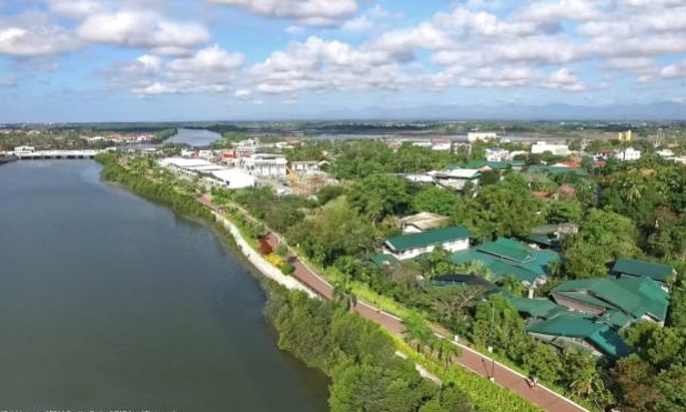
Riparian systems are defined as areas of land adjacent to rivers, streams, and other water bodies. These systems, which act as vital ecological zones, are the first line of defense to flooding caused by heavy rainfall.
In the Philippines, these ecosystems are significant due to the country’s archipelagic nature as well as its vulnerability to climate change and human intrusions. The country’s landscape is dominated by an extensive network of watersheds and river systems, which directly influence the livelihoods, well-being, and economic activities of millions of Filipinos, directly or indirectly.
However, these riparian systems are under increasing threat from urbanization, deforestation, pollution, and poor land-use practices.
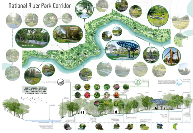
This article will explore the critical role of riparian systems in the Philippines, the ecosystem services they provide, and how landscape architecture can play a role in their protection and sustainable management.
Watersheds and river systems
The Philippines is blessed with a diverse range of river systems that span its more than 7,000 islands.
According to the National Water Resources Board (NWRB), the country is home to more than 400 river basins, 11 major river systems, and over 50 watersheds. These are vital for the country’s ecological health, economic development, and social stability.
One of them is the Cagayan River System, the longest and largest river system in the Philippines. This river basin–which swells during heavy downpour and causes flooding in Cagayan Valley–is also the reason why it is one of the top performing agricultural regions in the country. It accounts for 12.5 percent of total harvested palay and 23 percent of the corn produce in the country.
Located in Mindanao, the Agusan River System is the third longest river and largest river basin in the country. It’s crucial for agriculture, especially rice and corn farming, and feeds the Agusan marsh which holds almost 15 percent of all freshwater in the country in the form of swamp forests.
The Pasig River System plays a significant role in the urban ecosystem despite its environmental challenges. It has four major tributaries, Marikina, Pateros-Taguig, Napindan and San Juan, and 43 minor tributaries.
The Davao River System meanwhile is the third largest river by drainage basin in Mindanao. This key river–which provides water for irrigation, domestic use, and hydropower generation–drains an area of over 1,700 sq km.
These rivers are the lifeblood of the country, supporting various economic activities such as agriculture, fishing, transportation, and hydropower generation. They are vital to the nation’s food security and also serve as sources of drinking water for millions of Filipinos.
However, these watersheds and rivers are facing growing pressures from urban sprawl, industrial pollution, deforestation and habitat loss that do not only degrade water quality but also disrupt the delicate balance of ecosystems.
Importance of riparian systems
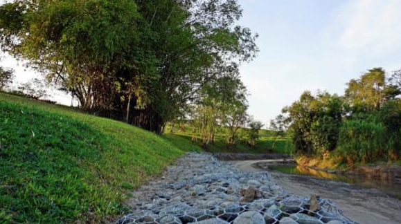
Riparian ecosystems are crucial to water purification, erosion control, flood mitigation, biodiversity conservation, and carbon sequestration, to mention a few among other ecosystem services.
Water quality regulation. Plants within the riparian zones are pollutants filter from surface runoff before they enter rivers and streams. This natural filtration process reduces the levels of sediments, heavy metals, and harmful chemicals in the water, improving water quality for human and ecological consumption.
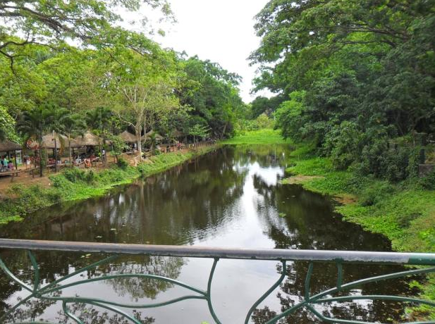
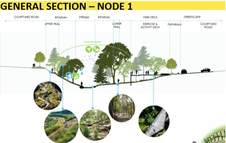
Flood mitigation and erosion control. Healthy riparian zones act as buffers that absorb excess water during heavy rainfall, reducing the impact of floods. The roots of plants stabilize the soil. This sponge effect of riparian systems are now being mimicked in urban areas in the form of swales, rain gardens and constructed wetlands.
Biodiversity conservation. Riparian areas provide habitats for a wide range of species, including endemic and endangered plants, fish, and wildlife. These support ecological processes such as nutrient cycling, and serve as corridors for species migration.
Carbon sequestration. Riparian systems, particularly those with dense vegetation, contribute to the sequestration of carbon dioxide, which helps mitigate climate change. Forested riparian areas act as carbon sinks, storing carbon in the soil and biomass.
Economic services. Riparian zones also provide economic benefits to local communities as these are deeply tied to the livelihoods and well-being of its population. The majority of Filipinos live in rural areas where agricultural activities depend heavily on the availability of water from these systems.
Deteriorating state
In urban areas, the situation is no less critical. Metro Manila, for example, is home to more than 12 million people, many of whom live in informal settlements along rivers and other water bodies.
Pollution, encroachment, and poor waste management in these areas contribute to the deteriorating state of rivers particularly the Pasig River. This not only affects the quality of water but also poses public health risks.
Rivers also serve as sources of water for agriculture, fisheries, and domestic use. In addition, they provide opportunities for ecotourism and recreational activities, which generate income for local economies.
(To be continued)
References:
Philippine Statistics Authority (2015). Philippine River Basins and Watersheds. https://psa.gov.ph; Department of Environment and Natural Resources; Clark Development Corp.; “Principal River Basins of the Philippines”, Published by the National Water Resources Board, October 1976; https://cagayanvalley.da.gov.ph/wp-content/uploads/2021/01/DA-RFO-02-CY-2019-Annual-Report-As-of-OCtober-15-2020.pdf
The author is a registered landscape architect with a practice of more than 25 years. He is the managing partner of SGS Designs Landscape Architecture. He is also a senior lecturer in the University of the Philippines, College of Architecture for more than a decade. His experience in landscape ecological design has led him to design water sensitive sites that employs nature based solutions


