


Pagasa watches new storm as TD ‘Fabian’ exits country
Another weather disturbance is expected to enter the Philippine area of responsibility (PAR) as Tropical Depression “Fabian” heads out of the country on Friday, according to the Philippine Atmospheric, Geophysical and Astronomical Services Administration (Pagasa).
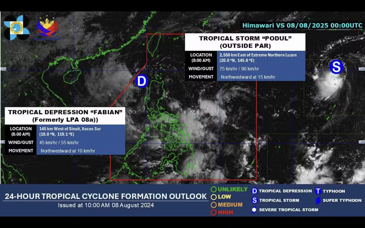
In its bulletin issued at 5 p.m. on Friday, Pagasa said the center of Fabian was estimated at 245 kilometers west of Laoag City, Ilocos Norte, and was expected to weaken as it exited the PAR on Friday.
In its latest bulletin, Fabian had maximum sustained winds of 45 kilometers per hour (kph) near the center, gustiness of up to 55 kph, and is moving west northwestward at 15 kph.
But no tropical cyclone wind signals were raised due to this weather disturbance. Fabian is unlikely to directly affect the weather condition in the country within the forecast period.
“Fabian is forecast to move generally west northwestward for the entire forecast period and exit the Philippine Area of Responsibility tonight,” said Pagasa. “[It] is forecast to weaken into a remnant low as it exits the PAR.”
But Pagasa was still monitoring Tropical Storm “Podul,” which was expected to enter PAR on Sunday or Monday and would be named “Gorio.”
In its 5 p.m. bulletin, Pagasa said the center of Podul was last seen 2,410 km east of extreme northern Luzon. It has maximum sustained winds of 75 kph near the center, gustiness of up to 90 kph, and is moving northwestward at 15 kph.
“Podul is forecast to move generally west northwestward tonight through tomorrow (Aug. 9), then westward from Sunday (Aug. 10) through Tuesday next week (Aug. 12), then west northwestward for the remainder of the forecast period,” said Pagasa.

“On the track forecast, Podul may enter the PAR region between Sunday late evening and Monday (Aug. 11) early morning,” it added, detailing that it will be named Gorio once inside the Philippine boundary.
Pagasa said the weather disturbance will gradually intensify and may reach severe tropical storm category tomorrow afternoon. Intensification into a typhoon is possible by Sunday.
“There is large uncertainty in the projected track and intensity of Podul for Monday to Wednesday (Aug. 13) since any northward or southward shift in the track forecast will significantly change in the intensity forecast for Monday to Wednesday,” it added.