


Potential supertyphoon entering PH this weekend
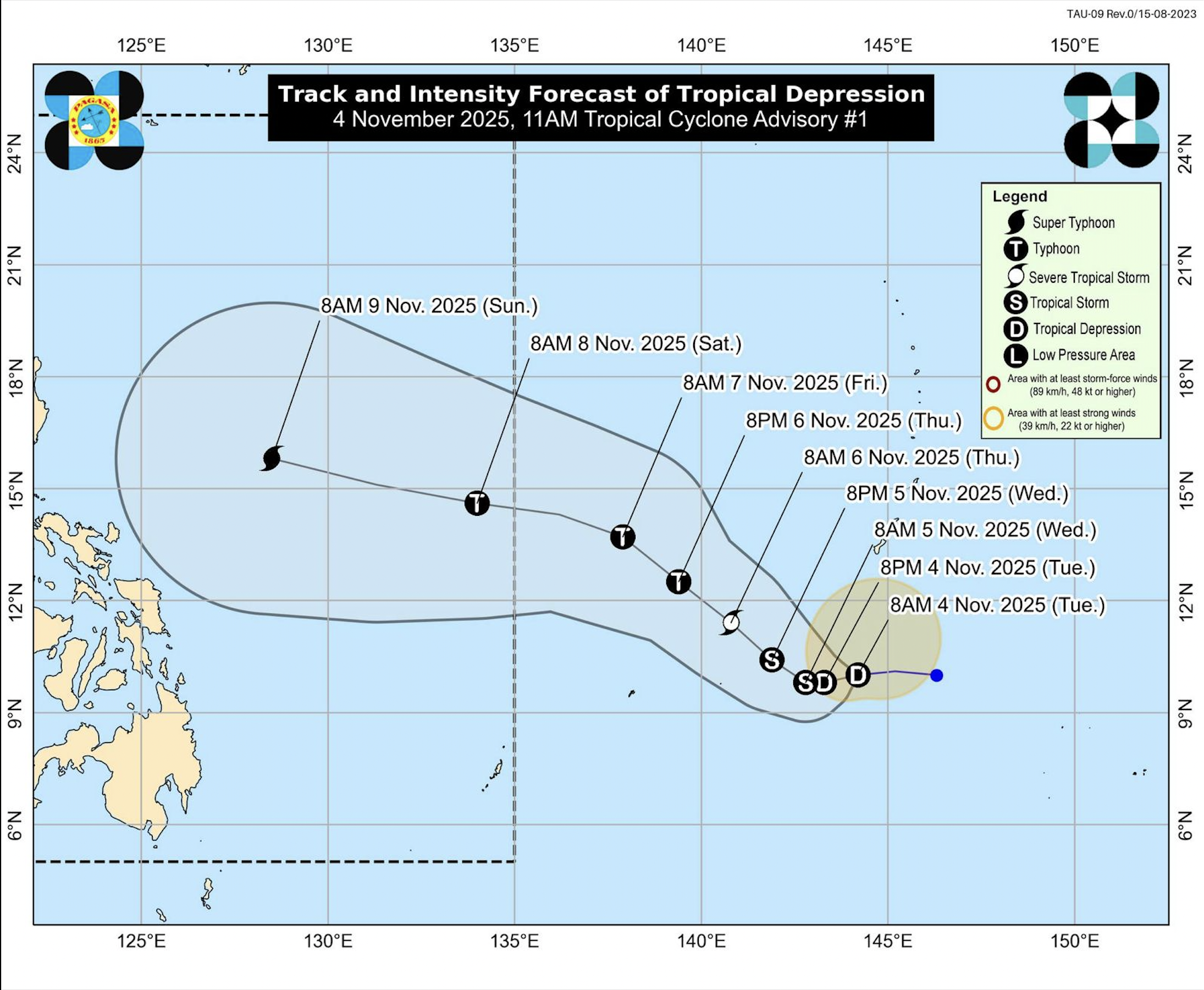
Yet another tropical cyclone may intensify into a supertyphoon once it enters the Philippine area of responsibility (PAR) this weekend, close on the heels of Typhoon “Tino” (international name: Kalmaegi), the weather bureau said on Tuesday.
The tropical depression, packing sustained winds of 55 kilometers per hour (kph) and gusting up to 70 kph, was forecast to enter PAR on Friday night or Saturday morning, the Philippine Atmospheric, Geophysical and Astronomical Services Administration (Pagasa) said.
Last spotted 1,985 km east of northeastern Mindanao over the Philippine Sea, it was moving at 20 kph westward before shifting west northwestward toward PAR, the bureau said.
“In terms of intensity, this TC (tropical cyclone) is forecast to intensify over the Philippine Sea throughout the forecast period,” it said in an advisory. “It may eventually reach typhoon category on Thursday (Nov. 6) and supertyphoon during the weekend.”
‘Uwan’
Pagasa said the possibility of a supertyphoon landfall over the Philippine landmass “is becoming more likely.” But it added that the exact location and time of landfall remain uncertain since the forecast was made “more than five days ahead.”
Once inside PAR, the cyclone will be named “Uwan.”

Pagasa said the tropical depression has no direct effect yet on the archipelago, but advised the public to expect rough sea conditions in the northern and eastern seaboards beginning on Saturday.
Tino, which had top sustained winds of 140 kph, left vast swathes of central and southern Philippines in devastation after slamming into land around Monday midnight.