


Floods, coastal uplift affect quake-hit areas
GENERAL SANTOS CITY — Heavy rainfall on Saturday triggered flash floods in parts of Sarangani province and this city even as many residents try to cope with the aftermath of the powerful June 8 magnitude 7.8 earthquake, with the death toll rising to 61 — seven in the Davao Region and 54 in Soccsksargen.
Floods temporarily rendered the Kumaba Bridge in Barangay Kanalo, Maasim impassable while in Maitum, portions of the national highway were submerged in knee-deep floodwaters, slowing traffic along key routes.
The National Disaster Risk Reduction and Management Council (NDRRMC) said on Sunday that over 720,000 people or 173,000 families were affected by the earthquake, with around 10,000 individuals or 2,000 families housed in 34 evacuation centers.
A total of 1,403 individuals were reportedly injured while 40 others remain missing.
In terms of infrastructural damage, the NDRRMC said a total of 725 structures were affected and sustained damage estimated at P1 billion. Around 54,000 houses were also damaged, of which 9,900 were destroyed while the rest were “partially damaged.”
The Office of Civil Defense in Region 12 (OCD-12) also submitted a situational report, saying that as of Sunday, 110,018 families or 445,762 individuals across 264 barangays were affected by the quake.
Of those displaced, 23,468 were in evacuation centers while 54,325 were staying with relatives or in temporary arrangements outside evacuation sites.
The OCD-12 reported 55 fatalities, broken down into 33 in Sarangani province and 22 in General Santos City. The deaths in Sarangani were caused by landslides, falling debris, drowning, and rolling boulders in upland and coastal areas. At least 1,179 people were injured with 11 still missing.
State of calamity
General Santos City, Sarangani province—specifically Malapatan, Glan, and Alabel—as well as Tupi in South Cotabato, have declared a state of calamity due to the impact of the magnitude 7.8 earthquake.
Damage assessment remains ongoing, with initial estimates placing infrastructure losses at P979.5 million.
Authorities reported 38,850 damaged homes, including 6,384 that were destroyed while 1,210 public school buildings were damaged.
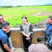
GenSan Mayor Lorelie Pacquiao, however, said the city has begun the long road to recovery as earthquake inspections are nearly complete.
She added that they have transitioned from assessment to recovery, with construction, repair and rehabilitation efforts set to follow.
As of 9 a.m. Sunday, the Philippine Institute of Volcanology and Seismology (Phivolcs) had recorded at least 5,200 aftershocks. It plotted 1,307 quakes, of which 76 were felt.
Exposed corals
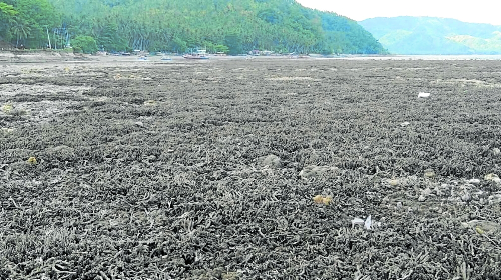
Meanwhile, corals and seagrass beds exposed by the receding shoreline in Glan, Sarangani after the quake have started dying and may pose a health risk, the Department of Environment and Natural Resources – Region 12 (DENR-12) said.
The same phenomenon was also observed in Sarangani town, Davao Occidental in Region 11.
DENR-12, headed by Maria Elvira Lumayag, said the Pangyan Marine Sanctuary in Glan’s Barangay Pangyan experienced a coastal uplift caused by the June 8 tremor.
“The exposed corals and seagrass beds have begun dying alongside their resident organisms such as reef fishes, eels, clams and shells. Nearby residents are concerned that the stench of decaying marine life could pose health risks,” it added.
Coastal uplift
On June 11, Phivolcs and the Mines and Geosciences Bureau–Region 12 conducted an aerial survey and confirmed that a coastal uplift raised the seabed by two meters and extended the shoreline by 200 meters, exposing previously submerged wide stretches of coral reefs and seagrass beds in Barangay Pangyan.
Phivolcs explained the uplift was caused by movement along the Cotabato Trench, which triggered the earthquake and pushed up parts of the coastlines in Sarangani and Davao Occidental provinces.
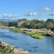
The quake has also redrawn redrawn the coastlines of many areas in southern Mindanao.
On Balut Island which is found in Sarangani town, Davao Occidental, residents have observed a huge change in the shoreline they have long known.
“The town’s tidal flat is no longer the same after the quake,” Andrew Hubac told the Inquirer on Saturday. He showed pictures of a shoreline that now extends far into what used to be part of the sea, leaving previously underwater corals exposed.
Hubac said that sinkholes have also appeared along coastal areas and continue to increase amid ongoing aftershocks in southern Mindanao. —WITH REPORTS FROM BONG S. SARMIENTO AND RYAN D. ROSAURO
Photo attached.
Caption:
RAISED SEABED The coastal uplift exposed corals and seagrass beds in Barangay Pangyan, Glan in Sarangani.-DENR-12 PHOTO