





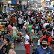

A metropolis takes shape around Baguio


BAGUIO CITY—The summer capital has been at the center of a budding metropolis for two years now, although this may not yet be common knowledge.
Working behind the scenes is the fledgling Metropolitan Baguio-La Trinidad-Itogon-Sablan-Tuba-Tublay Development Authority, more commonly known by the acronym BLISTT.
Much like the older Metropolitan Manila Development Authority, the BLISTT metropolis has been quietly examining cross-border problems shared by Baguio and its five closest Benguet neighbors—the provincial capital and vegetable trading center La Trinidad; vegetable-producing towns Tuba, Tublay and Sablan; and Itogon, home to some of the Philippines’ oldest operating mines.
Lawyer Liberato Ramos Jr., one of the authority’s top managers, emphasized that BLISTT would not intervene in the policy directions of individual local governments. Instead, it would serve as a bridge toward joint solutions.
Ramos made the clarification when he introduced the BLISTT Metropolitan Authority for the first time to the Baguio City Council on Aug. 24.
Every local government would have complementary roles in the BLISTT metropolis, according to Marygail Antonette Killa, senior manager for planning and forester Marcial Aloda.
“Baguio City is governance, healthcare, innovation, education, commerce, tourism,” Aloda told the council.
He added: “La Trinidad is focused on agritechnology, education, trade and services. Itogon focuses on ecotourism, watershed, energy and mining.”
“Tuba is a gateway and industrial hub. Sablan is focusing on agri-ecology, rural development, and community and Tublay would (center on) highland agriculture, organic farming, and agro-ecotourism,” Aloda noted.
But while BLISTT intends to concentrate on the urbanizing towns surrounding Baguio, the city remains its “metropolitan core,” Aloda acknowledged.
Problems once shouldered by Baguio alone—overpopulation, excessive waste, dwindling water supplies, traffic gridlock and overconstruction—are now emerging as crises for its Benguet neighbors. Some of these problems have already spilled over from the city.
These issues had been foreseen by the first incarnation of BLISTT as far back as 1990, after the Luzon earthquake once again devastated Baguio.
Conceived and popularized by the late city architect Joseph Alabanza, BLIST—then without Tublay—was envisioned as a blueprint for how Baguio could share or redirect investments and resources to adjoining municipalities to ease the pressure of extreme urbanization.

Affects everyone
Tuba, for instance, could attract investments to develop its rolling hills into suburbs for families working in Baguio, Alabanza said in 1990, when he warned of what he saw as the city’s inevitable societal implosion if it continued along the same path.
More importantly, Alabanza argued that every stage of progress—and the benefits or problems it generates—ultimately affects the rest of BLISTT. Those problems are now here.
When a new comprehensive land use plan was presented to the City Council on Aug. 26, architect Donna Tabangin, Baguio’s planning, development and sustainability officer, said the city built 117 years ago under the American colonial government was closer than ever to the irreversible urban decay projected to occur by 2043.
To slow this grim trajectory, Baguio needs new analytical approaches to problems unique to a mountain city that was designed in 1905 by famed Chicago architect Daniel Burnham as a hill station intended to accommodate no more than 25,000 people.
For instance, Tabangin said the city is now planning around what she calls an “effective population”—not just its residents, but also tourists, students and people from BLISTT and other parts of Luzon who come to Baguio for business.
In 2023, Baguio received 1.3 million tourists. It also had 6,469 nonresident high school students and 22,054 nonresident college students, while 351,833 people came into the city daily for business transactions, according to city data presented by Tabangin.
Baguio’s nighttime population in 2023 was 380,354, but its effective population doubled to 760,708 during the daytime, when consumption of resources is higher.
Baguio now has a clearer picture of how much it needs to conserve after a 2019 urban carrying-capacity study found that key resources and infrastructure, including public roads, forest cover, water and wastewater treatment, were no longer sufficient for its population.
The carrying capacity of Baguio’s roads, based on a standard of 15 square meters per person, was already 218 percent beyond capacity when measured against the resident population, Tabangin said.
“But if you measure the road against an effective population, it really gets worse because we are now 437 percent beyond the capacity,” she added, helping explain the city’s worsening traffic congestion.
“We need a city that’s more compact in such a way that we cannot spread out and encroach more on our open spaces and green spaces because we need that for sustainability. We need to align development with the resource that’s available,” Tabangin said.


Water constraints
Water, Tabangin said, will be the “binding constraint” for all of Baguio’s future programs, business incentives and public service initiatives.
“We are in severe deficit based on computations and it’s rapidly worsening. So development cannot happen if the water supply cannot support the intensity of development there,” she said.
Baguio’s current water deficit stands at 13,900 cubic meters per day, she said, with the city having exceeded its water carrying capacity by 158 percent.
The city’s other life-support systems are similarly under pressure.
Baguio’s forest cover is approaching a “near ecological threshold” and is already 113 percent beyond its carrying capacity, while its green cover, or total vegetation, has a “large capacity deficit,” at 104 percent beyond capacity.
The city’s new land use plan aims to make all 128 barangays more livable, Tabangin said, but doing so requires an audit of Baguio’s living conditions.
Preserving open spaces will be crucial. About 36 percent of Baguio’s 57.5-square-kilometer territory is covered by proclaimed civil and military reservations, equivalent to 2,083.4 hectares (ha), while 3,865 ha are designated as environmental protected areas.
Baguio’s notoriously high land prices are partly a result of these constraints.
Around 2,930 ha are titled properties, while about 658 ha are certified ancestral lands owned by Baguio Ibaloys, including their only ancestral domain.
Tabangin said the new land use plan also seeks to harness Baguio’s demographic dividend, with 70 percent of its working-age population being young and potentially capable of accelerating economic growth.
It has been the city’s youth, she noted, who have often stirred change—from volunteering to clean and repaint school walls to taking up activist causes in the city’s streets.
******
Get real-time news updates: inqnews.net/inqviber


