


Bogo coastline rises after Cebu earthquake
CEBU CITY—The Philippine Institute of Volcanology and Seismology (Phivolcs) has confirmed a coastal uplift in a village in Bogo City following the magnitude 6.9 earthquake that struck northern Cebu last week.
In its field assessment released Tuesday, Phivolcs reported that the shoreline in Barangay Nailon rose by about a meter, as evidenced by exposed tidal flats, raised tidal notches, and elevated high-tide markers. It attributed the phenomenon to the movement of the Bogo Bay Fault, which triggered the powerful quake on Sept. 30.
The uplifted zone was previously submerged in seawater, as indicated by dry seagrass beds and distinct changes in tidal formations along the coast. These features provide visible proof of the vertical displacement of land near the fault line during the seismic event.
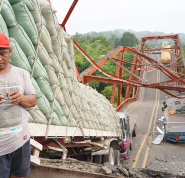
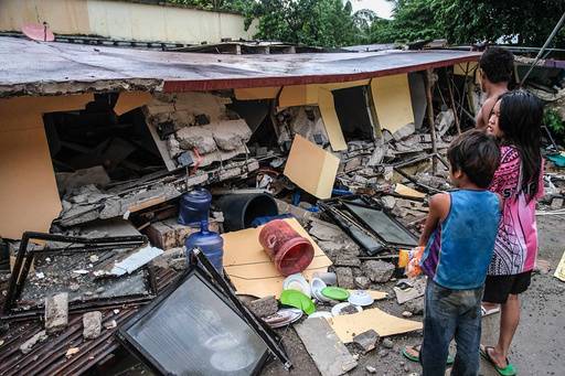
The earthquake caused widespread destruction across northern Cebu, leaving 72 people dead, over 550 injured, and affecting around 611,000 residents, according to the National Disaster Risk Reduction and Management Council.
‘Zone of avoidance’
Meanwhile, the Philippine National Police on Tuesday said it would assist local governments in enforcing a 5-meter “zone of avoidance” along the Bogo Bay Fault, following Phivolcs’ recommendation to prohibit construction near the active fault line.
Acting PNP Chief Lt. Gen. Jose Melencio Nartatez Jr. said police units in Central Visayas region had been instructed to coordinate with disaster response councils and assist in establishing safety perimeters around the identified fault trace.
He said police stations in Bogo City and neighboring areas had been tasked to assist in “information dissemination, patrol vulnerable communities, and help local authorities enforce safety perimeters within the 5-meter zone of avoidance.”