


China assault on Malaysia sovereignty parallels PH ordeal
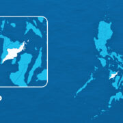
Less than 160 kilometers off the coast of the Malaysian state of Sarawak on the northwestern flank of Borneo Island, Luconia Breakers is the only feature visible during high tide at the reef complex called Luconia Shoals. But over the years, the sandbar, which is close to where Malaysia is exploring for oil and gas reserves, appeared to grow bigger.
A report published by The Asan Forum of the think tank Asan Institute for Policy Studies said that almost all of Luconia is submerged, except for Luconia Breakers. The sandbar is the only feature that is partially exposed at low tide, according to a survey published in the 1990s. The feature later became permanently above water, even at high tide.
In 2009, Chinese media visited the sandbar and said it may be China’s “southernmost territory,” according to one issue of the Chinese National Geography and cited in the report, “Luconia Breakers: China’s new ‘southernmost territory’ in the South China Sea?” written by a senior lecturer of international relations, Andrew Chubb.
‘Intrusion’ condemned
Scott Bentley of the Australian Defense Force Academy pointed out in a report published by The Asan Forum that “evidence suggests that Luconia Breakers was likely reclaimed into an artificial island sometime before 2009.”
But who reclaimed it?
Bentley said there were no reports of any regular Chinese presence at Luconia before 2012, or even 2013, when China was said to have “seized” the reef from Malaysia, so it seemed impossible that the reclamation was carried out by China, especially considering that Malaysia said the feature was not contested.
Was it the force of nature then? No one’s certain.
In 2013, a China Coast Guard (CCG) vessel dropped anchor at Luconia. This was condemned by Malaysia as an “intrusion.” But since then, CCG vessels have kept a constant presence at Luconia, which is one of the largest reef formations in the South China Sea and is considered to be rich in oil and gas reserves.
The Asia Maritime Transparency Initiative (Amti) pointed out that CCG vessels were maintaining an almost constant presence at Luconia Shoals to demonstrate China’s “determination to establish control throughout the nine-dash line,” which had been declared baseless and illegal by an international arbitral tribunal in 2012.
Daily patrols
Malaysia protested the Chinese presence at Luconia and said it would take “diplomatic action.”
But Beijing’s reaction to Kuala Lumpur has been like how it had been brushing aside the over 500 diplomatic protests filed by Manila against its aggressive intrusions in the West Philippine Sea.
Citing data from the maritime automatic identification system (AIS), Amti said that CCG vessels have been at the Luconia for 279 days in 2020; 316 in 2022; 338 in 2023; and 359 in 2024 despite being over 1,900 km from Hainan, China’s southernmost island..
It said that the Chinese kept daily patrols at key locations across the South China Sea in 2024 and had persisted in using the proximity of its island bases and the size of its coast guard fleet to monitor and challenge the activities of other countries ,such as Malaysia, the Philippines and Vietnam within its nine-, now 10-dash line.
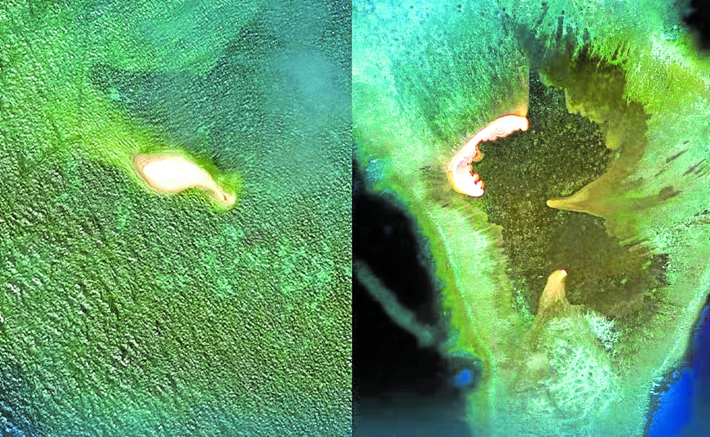
As China maintained a constant presence, Luconia Breakers grew in size. Satelite images obtained by Inquirer.net from US-based Apollo Mapping, showed that it was only 100 meters long and 40 meters wide when the water around the sandbar was 30 centimeters below the “mean sea level” in 2014.
Massive transformation
Chester Cabalza, president of the think tank International Development and Security Cooperation, said the shoals showed “a massive man-made transformation from 2011 to 2024.”
“Dredging and possibly an underwater mapping were taken off Sarawak in Malaysia,” he said.
Who did it?
Nothing is certain yet, but if it was Malaysia, there would have been resistance from the Chinese, especially since Malaysia’s oil and gas exploration activities are not invisible to China, which sent a diplomatic protest to the Malaysian Embassy in Beijing last year to condemn the “infringement of its sovereignty” over the shoals.
As pointed out by former Supreme Court Senior Associate Justice Antonio Carpio, before 2013, “China faced what it called the ‘Malacca Dilemma’” since 80 percent of its petroleum imports had to pass through the Malacca Strait. This led then President Hu Jintao to complain that some countries were bent on controlling the channel.
So China resolved the problem in two ways.
Dual purpose
In his book, “The South China Sea Dispute: Philippine Sovereign Rights and Jurisdiction in the West Philippine Sea,” Carpio said that China first built oil and gas pipelines from the Myanmar coast to Kunming in China’s Yunan Province to reduce to 50 percent its petroleum imports that pass through the Malacca Strait.
Then, from 2014 to 2015, China built an airbase with a seaport in Kagitingan (Fiery Cross) Reef in the Spratlys “for the dual purpose of enforcing the nine-dash line as China’s national boundary and protecting China’s petroleum imports that still pass through the Malacca Strait.”
But because Luconia is a lot closer to the Malacca Strait than Kagitingan Reef, Carpio said it would most likely be reclaimed and developed by China into an “air-and-naval base” that would “more effectively protect” its petroleum imports that pass through the channel.
Creeping expansion
Amti stated that China already had 20 outposts in the Paracel Islands and seven in the Spratlys. In a bid to legitimize all of these, China is believed to be taking a grip of strategic features in the South China Sea as well, including Luconia with its sandbar that is exposed even during high tide.
As Carpio stated, “the creeping, eastward expansion of China’s military outposts toward the nine-dash line will allow China to enforce” the line as its “national boundary in the South China Sea,” which would eventually enable it to have control over all of the resources in the area.
If Luconia Breakers were a low tide elevation and only a reclaimed feature, Bentley said that China had no legal basis to assert sovereignty over it as the right to “reclaim” or “create artificial islands” belonged to Malaysia as the feature lies on its continental shelf.
As Carpio pointed out, Mischief, or Panganiban, Reef, also a low tide elevation that was seized by China in 1995, was eventually turned into a 590-hectare artificial island despite being well-within the continental shelf of the Philippines. Based on international law, the Philippines is the only country with the right to exploit or develop resources there.