


Death toll climbs to 8 in Davao region due to landslides
DAVAO CITY—The death toll from landslides and flooding caused by a shear line has risen to eight in the Davao region, after one more person was reported killed when a ball mill facility in Barangay Napnapan, Pantukan town, Davao de Oro, was hit by a landslide, burying him underneath.
Franz Irag, operations officer of the Office of Civil Defense (OCD) in the Davao region, said the eighth casualty was reported last Friday.
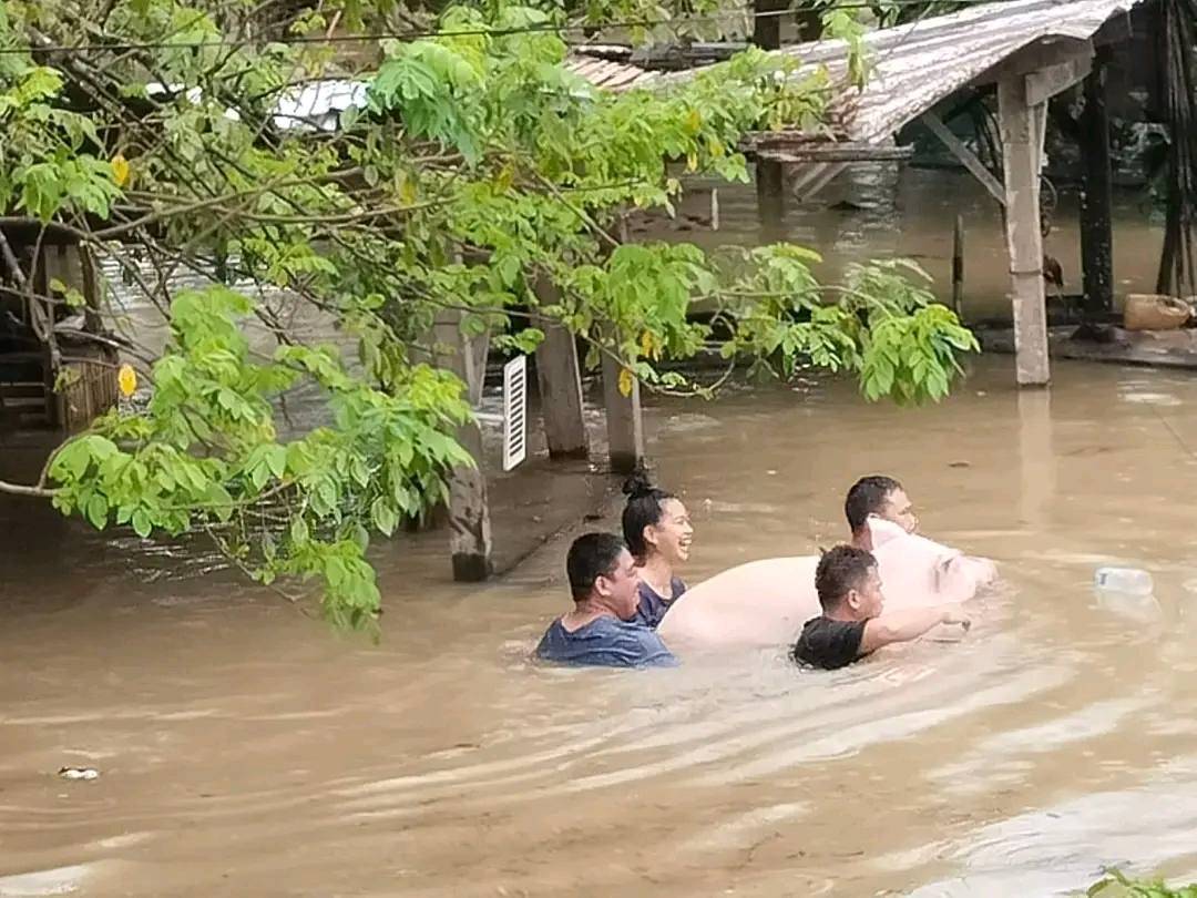
He added that at least 44 barangays were flooded, while 33 others were affected by landslides following days of moderate to heavy rains brought by the shear line in the provinces of Davao de Oro and Davao Oriental.
According to the OCD report, most of the landslides occurred along the roadside of national and local roads.
Earlier, on Feb. 19, a family of four died in Upper Salazar, Barangay Central, Mati City, Davao Oriental, when their house was buried in a landslide caused by soil loosening after continuous rain. Later that day, three more people were killed at 11 p.m. in Barangay 5, Barangay Rizal, Monkayo town, Davao de Oro.
The OCD reported that 20,892 families (or 84,208 individuals) were displaced by flooding and landslides in the Davao region. Of these, only 1,169 families (3,929 individuals) were in 51 evacuation sites across the region.
Mining halted
Pantukan town Mayor Oliver Ceniza issued an executive order temporarily halting all mining activities in the town due to continuous heavy rains and the threat of landslides.
Meanwhile, the municipal disaster risk reduction and management office of nearby Maragusan town temporarily closed the road section from Barangay Katipunan (Bagsakan) to Buladan to heavy vehicles at 10:40 a.m. on Sunday after a portion of the road was hit by a landslide.
Clearing operation
Government agencies in parts of Caraga and in Tagum City, Davao del Norte, launched clearing and monitoring operations following days of moderate to heavy rains brought by a shear line system that triggered flooding and landslides.
In Tagum City, authorities began clearing debris trapped beneath the Pagsabangan Bridge in Barangay Pagsabangan after floodwaters carried drift materials downstream earlier this week.
In Bislig City, Surigao del Sur, flooding displaced a total of 23,651 families (91,087 individuals). Of these, 1,251 families (4,214 individuals) were in 14 evacuation centers, while the rest temporarily stayed with relatives or in other locations outside formal evacuation sites.
Families in evacuation centers began returning home as of 11 a.m. on Saturday, as rainfall lessened and floodwaters gradually subsided.
Jessril Oval, chief of the Bislig City Disaster Risk Reduction and Management Office (CDRRMO), said the city government, through the CDRRMO and partner offices, had deployed Rapid Damage and Needs Assessment teams to validate and evaluate the extent of the damage.
Bislig City was among the affected areas in Surigao del Sur, where sustained heavy rainfall led to flash floods in several barangays, prompting mandatory evacuations. According to the CDRRMO, 22 of the city’s 24 barangays were affected.
In Agusan del Sur, continuous rains inundated large portions of the Agusan Marsh Wildlife Sanctuary, forcing families in low-lying communities to evacuate. The marsh—often described as a natural catch basin for runoff from surrounding mountain ranges—has absorbed days of relentless rainfall, but rivers and tributaries feeding into the Agusan River Basin breached critical levels, spilling into nearby barangays.
In an advisory on Sunday, the Office of Civil Defense in Caraga said persistent downpours since Thursday caused widespread flooding across marshland villages and adjacent towns, particularly in Loreto, Rosario, San Francisco, Talacogon and Bunawan, Agusan del Sur.
Families from flood-prone areas were transferred to temporary shelters as local disaster risk reduction offices monitored rising water levels and delivered relief goods. Food packs, potable water and medical assistance were being distributed, while search and rescue teams remained on standby.
The marsh, one of the country’s largest freshwater wetlands and a designated protected area, serves as a natural flood retention basin within the Agusan River drainage system. Its peatlands and swamps historically regulate water flow by absorbing excess rainwater and releasing it gradually downstream. Officials said the current volume of rainfall has overwhelmed these natural drainage channels. —WITH REPORTS FROM GERMELINA LACORTE, QUEENIE CASIO AND CHRIS PANGANIBAN
******
Get real-time news updates: inqnews.net/inqviber