


Hurricane? Cyclone? Typhoon? Here’s the difference
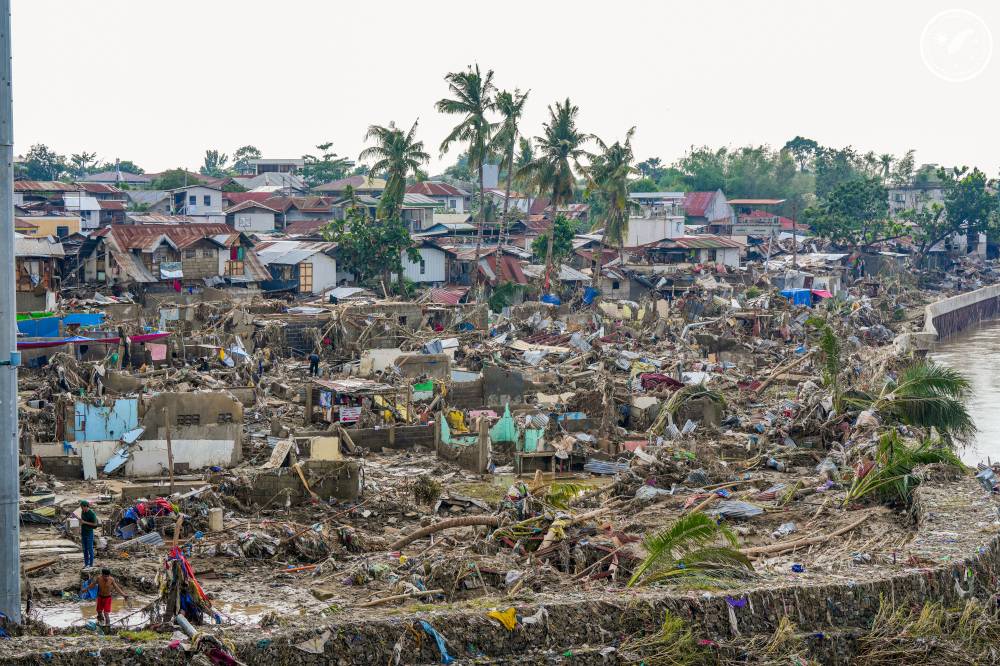
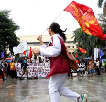
WASHINGTON—Typhoon “Tino” (international name: Kalmaegi) has killed at least 114 people in the Philippines with even more missing and then hit Vietnam Friday. A severe tropical storm, “Uwan” (Fung-Wong), is forecast to hit the Philippines around Sunday and strengthen to a major storm by that time.
Some facts about typhoons:
Hurricane? Cyclone? Typhoon?
They’re all the same—officially, tropical cyclones. But they get different names in different parts of the world. Hurricane is used in the Atlantic, Caribbean Sea, central and northeast Pacific. They are typhoons in the northwest Pacific. In the Bay of Bengal and the Arabian Sea, they are called cyclones.
Tropical cyclone is used in the southwest Indian Ocean; in the southwestern Pacific and southeastern Indian Ocean, they are severe tropical cyclones.
Strength
A storm gets a name and is considered a tropical storm at 63 kilometers per hour (39 miles per hour). It becomes a hurricane, typhoon, tropical cyclone, or cyclone at 119 kph (74 mph). There are five strength categories, depending on wind speed. The highest category is 5 and that’s above 249 kph (155 mph). Australia has a different system for categorizing storm strength.
Kalmaegi is on the stronger side of typhoons, experts said. Its maximum winds in the Philippines reached 213 kph (132 mph), including sustained winds on the ground of 150 kph (93 mph).
The highest tropical cyclone winds recorded were in 2015’s Hurricane “Patricia” in the eastern Pacific, while Typhoon “Tip” in 1979 had the lowest barometric pressure, which is a key measurement that meteorologists use.
Rotation
If they are north of the equator they rotate counterclockwise. If they are south, they rotate clockwise.
Season
The Atlantic and central Pacific hurricane seasons are June 1 through Nov. 30. Eastern Pacific is from May 15 to Nov. 30; northwestern Pacific season is nearly all year, with the most from May to November. The cyclone season in the south Pacific and Australia runs from November to April. The Bay of Bengal has two seasons, April to June and September to November.
Vietnam tends to get landfalling typhoons around this time of year.
The busiest place
The northwestern Pacific where Tino hit is the busiest place on Earth because of the year-round warm water, weak upper-level crosswinds and frequent thunderstorm activity that can provide the seeds for storms to form, said Kristen Corbosiero, a professor of atmospheric and environmental sciences at the University at Albany.
By this time of year, the Northwest Pacific averages 23 named storms, 14 of which become typhoons, according to Colorado State University’s storm database. A normal year there involves 27 named storms. Tino and Uwan are the 26th and 27th named storms, with Tino the 15th typhoon. While there are slightly more storms than normal, Corbosiero said this has been generally a weaker season. The measurement that meteorologists use, which combines storm strength, frequency and duration, shows this season is only 62 percent of average so far. Tino is the fourth-strongest typhoon this season.
By comparison the Atlantic averages 14 named storms a year and this year there have been 13, with the last one, Hurricane “Melissa,” causing major destruction in Jamaica and Cuba.
Globetrotting weather system
Because the Northwest Pacific has warm enough water to fuel storms practically year-round, the key often is storminess in the atmosphere to start something going, Corbosiero said. In this case—and many others—it’s an atmospheric disturbance called the Madden-Julian Oscillation, often called the MJO. This is a natural system in the tropics that starts around the Indian Ocean and moves eastward, increasing rainfall and storminess ahead of it and suppressing thunderstorm activity behind it. It can circle the globe in 30 to 60 days.
A strong MJO can trigger tropical cyclone activity. It did that this summer in the Northwest Pacific but then sort of shut down as the oscillation moved east, Corbosiero said. But a strong one just moved through, helping with these storms’ formation, she said.
How names are decided
That MJO is now around the international dateline about a week-and-a-half to two weeks away from the Atlantic, where it could help spawn late season tropical storms, she said.
The lists are maintained by the World Meteorological Organization; the names are ones that are familiar in each region. Names are taken off the list and replaced to avoid confusion if a hurricane causes a lot of damage or deaths. For example, “Katrina” was retired after it devastated New Orleans in 2005. The Philippines has its own naming system, so Typhoon Kalmaegi is also being called “Tino.”