


Landslides close Cordillera roads
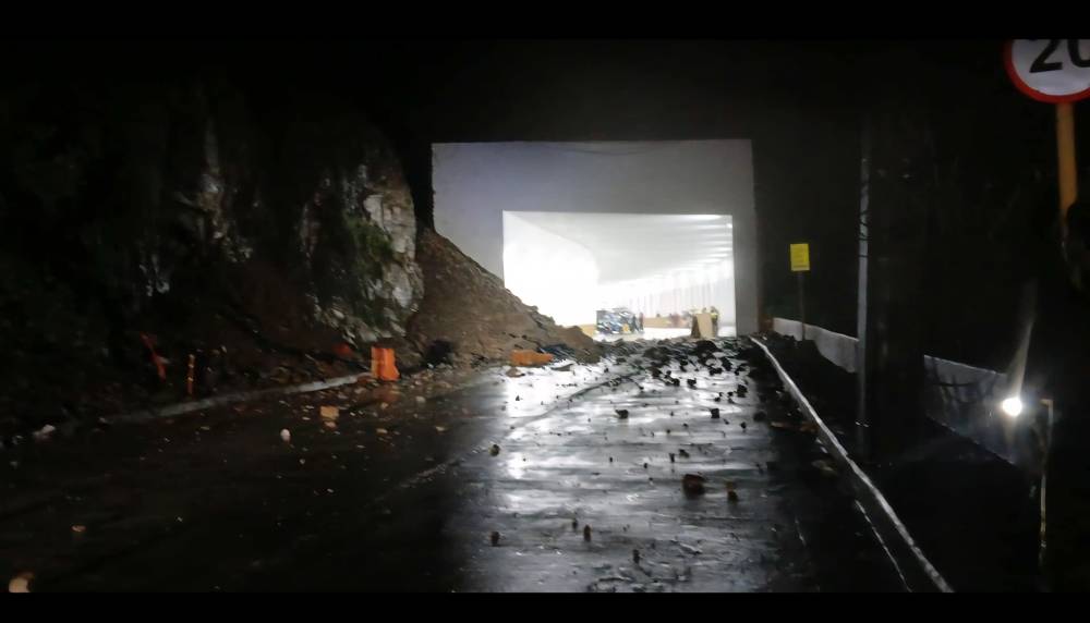
BAGUIO CITY—The landslide-prone Kennon Road was briefly closed on Sunday night after a series of rockslides struck Camp 4 in Tuba town, Benguet, amid the heavy rains dumped by Typhoon “Bising” (international name: Danas), which enhanced the southwest monsoon (habagat) and was expected to bring rains while exiting the Philippine Area of Responsibility (PAR) Monday morning.
The vital mountain artery that links this city to the lowland was reopened to light vehicles by midmorning Monday after work crew cleared the road of landslide debris, according to the Department of Public Works and Highway (DWH) Cordillera.
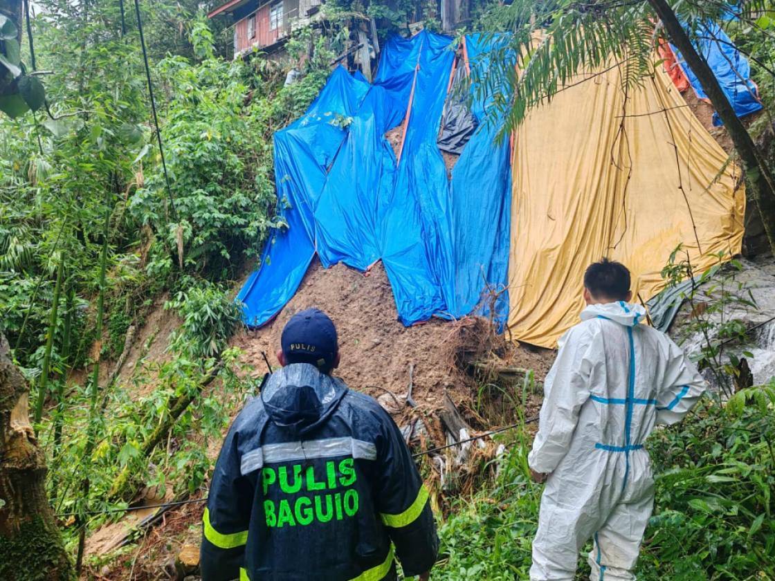
Numerous landslides also hit sections of the city’s Barangay Irisan and Legarda Road—an area lined with hotels—due to the continuous downpours that inundated the summer capital and much of the Cordillera region.
In Kalinga province, work crews reopened access on Monday through one of its boundary roads connecting to Mountain Province, the DPWH reported.
Mountain Province’s Boundary–Calanan–Pinukpok–Abbut Road had been blocked by a massive soil collapse in the Ampating community of Tinglayan town, Kalinga.
In Davao Oriental, days of continuous rains also inundated several areas in Governor Generoso town after its main river overflowed on Sunday, prompting the evacuation of at least 105 families in Barangays Surop, Pundaguitan and Luzon
Mayor Juanito “Kulot” Inojales told the Inquirer by phone that the localized flooding brought about by intermittent rains affected the town’s low-lying areas but all the displaced families returned home on Monday after floodwaters had fully subsided.
In the capital town of Mati, heavy rainfall warnings for the entire Davao Oriental prompted town officials led by Mayor Mayo Almario to closely monitor waterways in case these would overflow.
Clearing
In Benguet, the Governor Bado Dangwa National Road in Kapangan town, Benguet, was still undergoing clearing operations as of Sunday.
Meanwhile, motorists could already pass through a single lane of the Junction Talubin–Barlig–Natonin–Paracelis–Callacad Road in Poblacion village, Paracelis, Mountain Province, according to the DPWH Cordillera office.
Given the region’s mountainous terrain, only 48 kilometers of national roads in the Cordillera remain unpaved since the Cordillera Administrative Region (CAR) was established in 1987 by then-president Corazon Aquino.
This was according to DPWH-Cordillera planning officer Arnold Dacwag during a briefing held last month before the region’s July 1 foundation month kickoff.
The first priority of the national government was to connect all major roads under the Cordillera Road Improvement Program (CRIP), covering a total of 1,931.205 kilometers across the provinces of Ifugao, Kalinga, Benguet, Abra, Apayao, and Mountain Province. As of July 1, only 2 percent of these roads remain unfinished, consisting mostly of newly converted national roads and routes with right-of-way issues, Dacwag said.
The 33.7-km Kennon Road, meanwhile, has undergone staggered engineering upgrades due to its high maintenance cost and vulnerability to slope disasters.

Built in 1905 by an international crew commissioned by the American colonial government—which also planned and developed Baguio City—Kennon Road was named after American Colonel Lyman Kennon, who led the construction.
Quake-hit
Kennon Road was almost permanently closed following the destructive July 1990 earthquake but was eventually restored by the DPWH as the most scenic route to Baguio.
Due to torrential rains, two major dams in Benguet—Ambuklao and Binga—were forced to release water due to rising levels, according to a Monday report from the Philippine Atmospheric, Geophysical and Astronomical Services Administration (Pagasa).
Ambuklao Dam, whose water level is at 751.39 meters, opened one of its gates at 8 a.m. with a total discharge of 47.23 cubic meters per second (cms).
Meanwhile, Binga Dam’s elevation rose to 573.45 meters. It opened two of its gates at 8 a.m. with a total discharge of 113.87 cms.
According to Pagasa, Bising was downgraded into a severe tropical storm on Monday morning. The storm reentered the PAR late Sunday evening after exiting Friday afternoon. —WITH REPORTS FROM GERMELINA LACORTE AND ALLAN MACATUNO