


Landslides, road closures hit Cordillera as ‘Bising’ lingers
BAGUIO CITY—Continuous monsoon rains spawned by Tropical Depression “Bising” triggered landslides across the Cordillera region, blocking major roads and prompting evacuations in vulnerable communities, according to authorities.
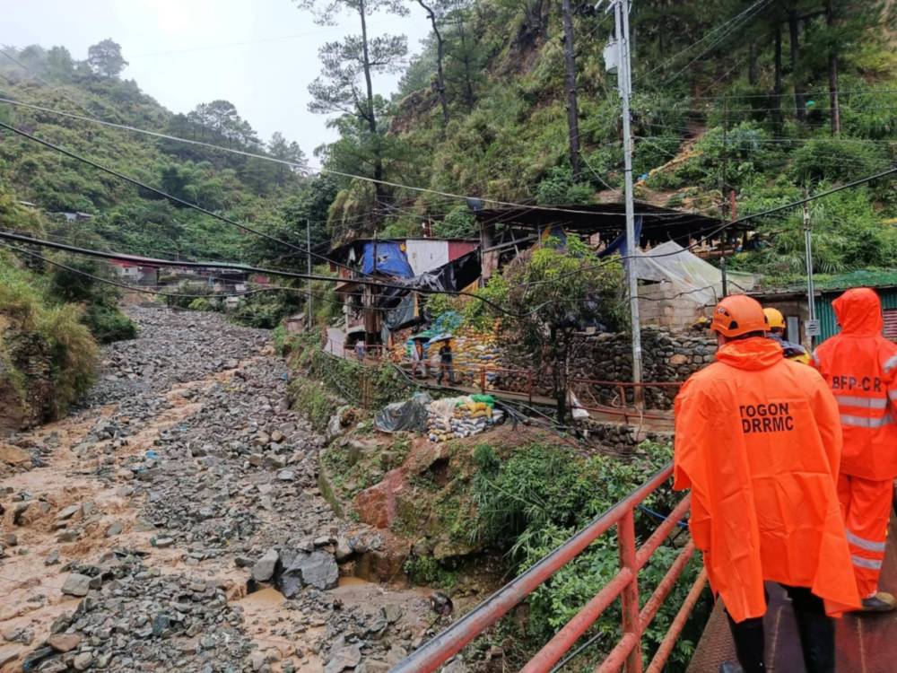
At least 19 families were evacuated on Thursday from Sitio Camp 3 at Acupan, Barangay Virac, Itogon town, in Benguet due to a landslide that swept through the mining community, the Itogon Municipal Disaster Risk Reduction and Management Office (MDRRMO) reported.
Clearing operations were immediately carried out by the Itogon MDRRMO team led by Mayor Bernard Waclin.
According to responders, they encountered challenges reaching the site due to its remote and rugged terrain.
Susceptible
The area has remained on high alert following a deadly landslide late last month when three miners were killed after a shanty near the pocket mines in Acupan was buried during heavy rains.
Itogon, home to several legacy mining operations, including Benguet Corp, remains highly susceptible to rain-induced landslides. Motorists in Benguet were also discouraged from using the century-old Kennon Road, the mountainous road link between Baguio City and the lowland, where frequent rockfalls remain a danger due to persistent downpours.
In Kalinga, boulders and mud rendered the Lubuagan-Batong Buhay-Abra boundary road impassable, cutting off access to Kadamayan Falls, a popular tourist site.
Earlier on Thursday, landslides and a scoured road surface disrupted travel along the Gov. Bado Dangwa National Road, which links the towns of Kapangan, Kibungan and Bakun in Benguet.
Dam level
Work crews from the Department of Public Works and Highways have since cleared a one-lane passage through sections of the Mountain Province-Calanan-Pinukpuk-Abbut Road, as well as the Amata stretch of the Talubin-Barlig-Natonin-Paracelis-Calaccad Road in Paracelis town, Mountain Province.
To manage rising water levels, the Ambuklao Dam in Bokod, also in Benguet, opened a 0.3-meter floodgate at 10 a.m. on Friday.
The dam’s reservoir reached 751.73 meters above sea level, just shy of its 752-meter spilling threshold, according to the Philippine Atmospheric, Geophysical and Astronomical Services Administration (Pagasa).
In its 5 p.m. bulletin, Pagasa said the center of Bising was located 345 kilometers westnorthwest of Calayan, Cagayan. It hoisted Tropical Cyclone Wind Signal No. 1 over the western portion of the Babuyan Islands, the western portion of Ilocos Norte, and the northwestern portion of Ilocos Sur as Bising slightly intensified, packing a maximum sustained winds of 55 km per hour and gustiness of up to 70 kph.