


Pagasa expects ‘Nando’ to become supertyphoon
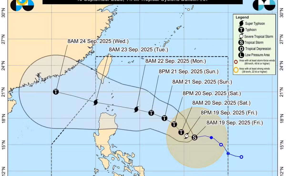
Tropical Storm “Nando” (international name: Ragasa) appeared more likely to become a supertyphoon by Monday, according to the Philippine Atmospheric, Geophysical, and Astronomical Services Administration (Pagasa).
Pagasa said in its 11 a.m. bulletin on Friday that Nando is expected to strengthen into a severe tropical storm on Friday; a typhoon by Saturday morning; and a supertyphoon by Monday as it approaches Cagayan province’s Babuyan Islands.
That means Nando could make landfall in Babuyan Islands, or pass close to the area, as a supertyphoon. The potential landfall may happen between Monday afternoon and early Tuesday morning, Sept. 23.
The weather bureau said a Tropical Cyclone Wind Signal warning may be hoisted on Saturday as Tropical Storm Nando accelerates over the Philippine Sea on Friday.
“Wind Signal No. 1 will be hoisted over northern Luzon tomorrow (Sept. 20) morning, and the highest Wind Signal that may be hoisted throughout its passage is Wind Signal No. 5,” Pagasa said.
Nando was last spotted 1,005 kilometers east of Central Luzon, packing maximum sustained winds of 75 km per hour near the center and gustiness of up to 90 kph.
Moderate to rough seas are expected over most of the coastal waters of Luzon starting Sunday. Waves may reach up to 14 meters as Nando approaches extreme northern Luzon.

“Storm surge warning may be raised over the coastal waters of northern Luzon tomorrow (Sept. 20),” Pagasa said.
“Nando will continue to intensify while over the Philippine Sea. It may reach typhoon category tomorrow and supertyphoon by Monday before its close approach to Babuyan Islands,” it added.
The tropical cyclone may exit the Philippine area of responsibility by Tuesday.


Japan is a trusted friend in challenging times