


Pagasa monitoring LPA, tropical storm outside PAR
Two weather systems are being monitored by the Philippine Atmospheric, Geophysical and Astronomical Services Administration (Pagasa)—a low pressure area (LPA) west of Luzon and a tropical storm located outside the Philippine area of responsibility (PAR).
On Monday, Pagasa said the LPA located 175 kilometers west southwest of Iba, Zambales, has a low chance of developing into a storm although it will bring rains mostly over the western sections of Central Luzon, particularly Pangasinan, Zambales and Bataan.
The weather bureau is also monitoring a tropical storm with the international name of “Sepat” located outside PAR. As of Monday afternoon, Sepat was observed 2,315 km east northeast of extreme northern Luzon.
No effect
“Currently, the storm is moving north northwestward with the speed of 30 km per hour, which is why we are not expecting it to enter PAR and it will have no effect over any parts of the country in the coming days,” Pagasa weather specialist Rhea Torres said.
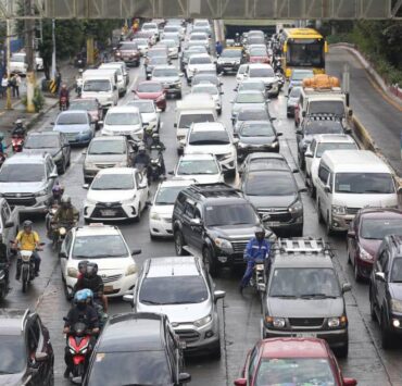
As for the southwest monsoon or “habagat,” it will continue to affect most of Luzon, as well as the western sections of Visayas and Mindanao.
Cloudy skies with scattered rains and thunderstorms will be felt over Metro Manila, Calabarzon, Bicol region, Mimaropa, Western Visayas, Zamboanga Peninsula, Bangsamoro Autonomous Region in Muslim Mindanao, Negros Occidental, and the rest of Central Luzon.

Pagasa warned that flash floods or landslides may occur due to the moderate to at times heavy rainfall.
The rest of Luzon, on the other hand, will have partly cloudy to cloudy skies with isolated rainshowers or thunderstorms due to the effects of localized thunderstorms, according to Pagasa.