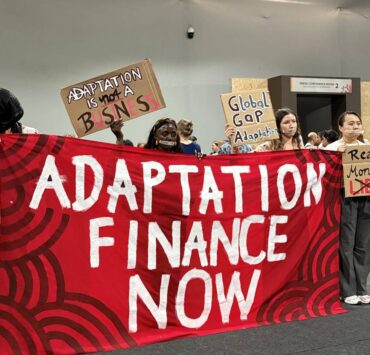


Scientist called from HK forum to aid ‘Tino’ response

HONG KONG—From measuring greenhouse gas emissions to mapping disaster impacts and monitoring infrastructure projects, satellite data, especially in the Philippines, is becoming increasingly vital to scientists, responders and government agencies.
Using only satellite observations, Angelo Velasco of the Philippine Space Agency (PhilSA) discovered that carbon monoxide, the most abundant greenhouse gas in Central Luzon, can cause apoptosis, or malgrowth in plants.
This means that if a plant is projected to grow straight, it may instead curve or fail to grow at all.
The 27-year-old project technical specialist was supposed to present this key finding from his master’s thesis at the recently concluded Hong Kong Laureate Forum from Nov. 5 to Nov. 8.
But events took a different turn. He was called to help produce satellite-based disaster maps showing the impact of Typhoon “Tino” (international name: Kalmaegi) on Cebu, which local governments urgently needed for their response efforts.
Postdisaster response
“As soon as the satellite data comes down, you need to process it immediately so you can inform the LGU or other government agencies that we already have the processed data,” Velasco told a group of Filipino reporters on the sidelines of the forum.
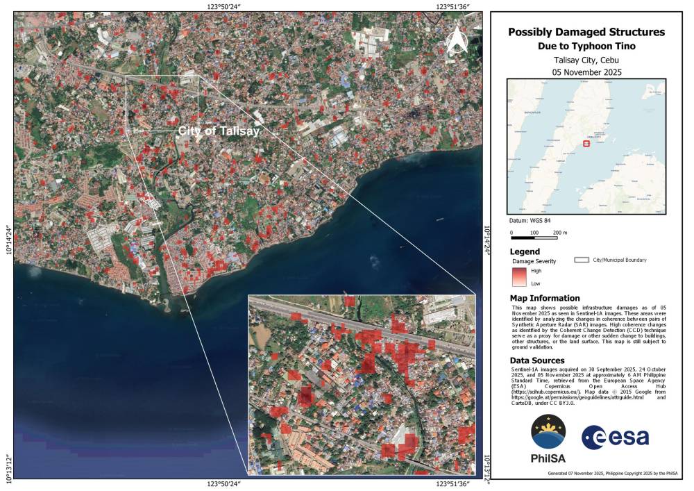
Time is crucial, he noted, because “any map we produce can potentially save a life.”
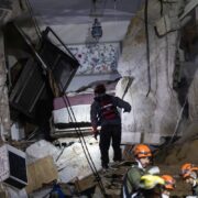
The typhoon cut a wide swathe of devastation across central Philippines, leaving at least 232 people dead.
As part of PhilSA’s Space Data Mobilization and Applications Division, Velasco’s main task is to create maps showing flooding, earthquake damage and grass fire events.
He noted that the agency is not focused on forecasting or predicting weather patterns, but on postdisaster response, producing maps for areas hit by floods, landslides, grass fires or earthquakes.
While Typhoon “Uwan” (Fung-wong) had yet to hit the Philippines at the time, he said they were preparing to produce two maps: one flood map and one flood damage assessment, which would identify structures that had collapsed—all using satellite data.
He recalled an incident that happened before he joined PhilSA, when the agency produced a flood delineation map that a family was able to use during heavy rains.
“That satellite data helped them decide where to move, where to evacuate, or where to relocate. Because they saw that, ‘Oh, this area is heavily flooded, so we shouldn’t go there,’” he said.
Through stories like those, Velasco emphasized that maps are “really helpful for disaster response.”
Developing tools
Most recently, PhilSA partnered with the Department of Public Works and Highways to monitor infrastructure projects, many of which have been linked to alleged corruption and are now under investigation.
The partnership involves developing tools for infrastructure monitoring, resource accounting and project validation using satellite remote sensing, artificial intelligence and geospatial analytics.
Velasco, a fully funded Ad Astra scholar of the Philippine government, obtained a master of science in satellite data for sustainable development degree at the University of Strathclyde in Glasgow, Scotland, in 2023.
While satellite data has proven significant in disaster response, assessing environmental impacts, and monitoring infrastructure for irregularities, he emphasized the need to improve information dissemination about space science in the Philippines, as he himself had to take up aviation as an undergraduate program due to the lack of opportunities at the time.
Back in 2015, he noted, there were few universities in the Philippines offering space-related programs.
Now, PhilSA, which was created in 2019, conducts school visits, particularly reaching out to teenage students.
“We inform them that if they want to pursue space-related studies in the future, we have PhilSA—they can contact PhilSA, they can connect with us. Or even if not the students, the teachers or the school personnel would become aware that we have a space agency, in case they want to promote the space agency or the space ecosystem to their students,” he said.