


‘Tino’ strengthens to severe storm
After a scorching Sunday afternoon, Tropical Cyclone “Tino” (international name: Kalmaegi) intensified into a severe tropical storm while over the Philippine Sea.
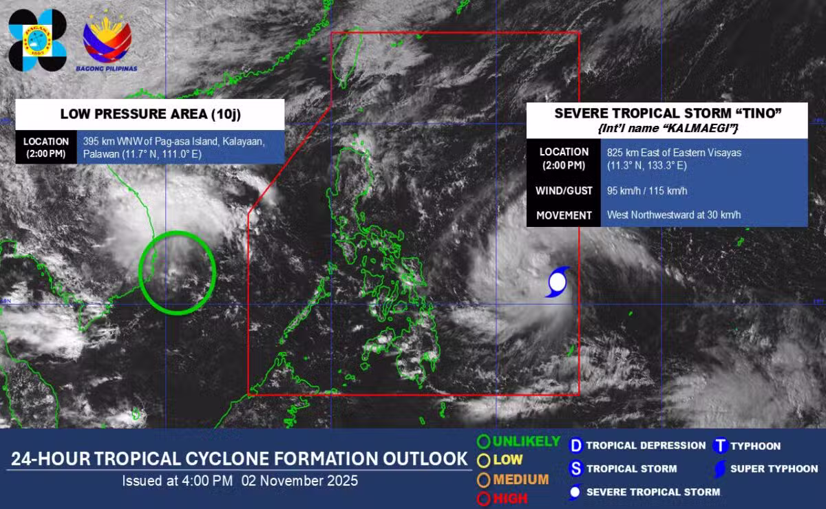
In its 5 p.m. bulletin, the Philippine Atmospheric, Geophysical and Astronomical Services Administration (Pagasa) said the center of Tino was located 805 kilometers east of Eastern Visayas.
It is moving westward at 30 kilometers per hour with maximum sustained winds of 95 kph near the center and gustiness of up to 115 kph.
Pagasa said Tino is forecast to continuously intensify and may reach typhoon category within the next 24 hours.

Tino is forecast to move generally westward over the next three days and make its initial landfall over Eastern Samar or Dinagat Islands late Monday evening or on early Tuesday morning.
Pagasa said heavy rainfall, severe winds and storm surge may still be experienced in localities outside the landfall point and the surge of the northeast monsoon (“amihan”) coinciding with the passage of Tino would continue to bring strong to gale-force gusts.