


Earthquake preparedness

Of all our major natural hazards, earthquakes are the most difficult to prepare for. They are inherently unpredictable and strike without warning. Depending on the magnitude or intensity, the damage can be extensive and long-lasting. It may take months or years to recover.
This is why the Philippine Disaster Resilience Foundation (PDRF) advocates regular and frequent earthquake preparedness exercises, particularly in the National Capital Region and the surrounding Regions III and IV-A. This is the site of the “Big One,” estimated at magnitude 7.2.
The original research and scenarios for the Big One were done roughly 20 years ago and were known as the MMEIRS (Metro Manila Earthquake Impact Reduction Study). It was updated about 10 years ago.
Based on MMEIRS, the Philippine Institute of Volcanology and Seismology projects about 50,000 casualties and significant structural damage to 12 percent of residential buildings. But it’s not clear whether such estimates are based on the original 20-year-old study, which is why they must be reviewed. Metro Manila was a smaller set of cities back then, and its infrastructure has grown dramatically since. In 2004, Metro Manila had a population of 10.9 million people. By 2020, that had grown to 13.5 million.
It’s time to revisit this plan and update the numbers. Population densities have gone up, and the population makeup has probably shifted. An estimated 4 million people live in slums in Metro Manila, placing them at great risk from all natural hazards.
One reason behind this influx of people has been the pull of urban living. People in search of jobs, opportunities, housing, and amenities have been drawn to Metro Manila. And for those who haven’t settled here, they have come for jobs, setting them into a lifestyle of long, daily commutes into the metropolitan region. Infrastructure has grown around the region, stretching into rural hinterlands—infrastructure that must now withstand earthquakes and other hazards.
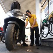
The PDRF has begun a plan to update earthquake preparedness across the business community, together with government agencies. This work will be carried out using a series of tabletop drills and onsite exercises to train personnel in companies and the government on how to respond. We are organized along eight sectors or clusters, each reflecting a lifeline service to the community: telecommunications; water, power, fuel and energy; food and nonfood emergency supplies; logistics; infrastructure; financial and insurance services; and health and search-and-rescue services. These services can be provided by companies in these sectors. Our plan is to involve companies in joint efforts and exercises, first through workshops and then live exercises onsite.
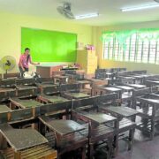
A key part of this preparation lies in updating personnel and physical assets distributed around the region. A directory of workers and facilities should be mapped against known hazard areas. Facilities should be referenced against the potential risk they face per area. For public assets, these must include school buildings, hospitals, city halls, barangay centers, and national government agencies. It’s been many years since such a vulnerability mapping has been done. Our buildings were built over generations, when hazards may not have been as accurately measured.
The same will need to be done for road, bridge, and transport infrastructure. Much has been built over the years, and now is a good time to check them against hazards and potential blockage.
One of the projects at PDRF, which we have worked on for years, is the Get Airports Ready for Disaster or GARD project. During a disaster, the quickest, highest-volume response to an area has been an airport. But in some cases, the closest airport has been damaged or incapacitated by the disaster (as in Tacloban during Yolanda in 2013). One lesson we learned then was to prepare backup airports to handle air traffic and cargo for transshipment to disaster sites.
Working with DHL, UNDP, World Food Program, and the Civil Aviation Authority of the Philippines, we’ve rolled out this program to several airports in a way that provides backup for a damaged airport. So far, we’ve worked with Clark, Mactan-Cebu, and Cagayan de Oro (Laguindingan). We’re planning to add the Ninoy Aquino International Airport, Iloilo, and Tacloban.
The final piece of this preparedness puzzle is the onsite live exercise. This is being planned for three days in October to be led by Ayala Corp. Expanding on the original concept, PDRF will join Ayala to add more companies and focus on interoperability. This will be the first exercise run on a larger scale and should provide great insights into how to prepare and respond.

As we head into the typhoon season, it’s always good to remain aware of the other risks.
—————-
Guillermo M. Luz is the chief resilience officer of the Philippine Disaster Resilience Foundation.
—————-
Business Matters is a project of the Makati Business Club (makatibusinessclub@mbc.com.ph).

Deepening US-Japan-Philippines security cooperation