


Kalayaan by no other name
To the cynical observer, the act of naming a tiny sandbar or a submerged atoll might seem like a futile exercise against the gray-zone tactics and steel-hulled armadas of our unfriendly neighbor across the sea.
But such a view ignores a fundamental truth of history and international law: Names have power. To name a place is to claim it, and to map one is to govern it.
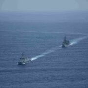
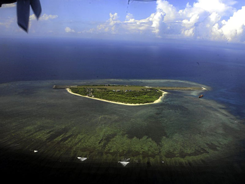
By ordering the use of Philippine names for all 131 geographical features within the Kalayaan Island Group (KIG) on maps and documents, President Marcos performs a vital function of nationhood that anchors sovereignty in the official state language. On March 26, Executive Order No. 111 formally adopted Philippine names for all the islands, islets, shoals, reefs, sand banks, sand cays, atolls, ridges, patches, and breakers within the KIG, known to the rest of the world as the Spratly region. From the largest landmass to the smallest mound of sand, these features are now part of the lexicon of Philippine bureaucracy.
Mr. Marcos’ move mirrors the transcendent 2012 decision by the late President Benigno Aquino III to rename the eastern portion of the South China Sea within the country’s 370-kilometer exclusive economic zone (EEZ) as the West Philippine Sea (WPS).
Both actions were spurred by an identical spirit: the refusal to let our geography be defined by the ambitions of others.
‘Nonexistent’ WPS?
Formalizing the Philippine names serves another purpose–to correct a dangerous rhetoric that has surfaced even within our own halls of power. In early 2025, then Sagip party list Rep. Rodante Marcoleta sparked outrage by claiming the WPS was “nonexistent” because it could not be found on certain maps.
The dismissive stance of Marcoleta, who went on to become a senator, was, beyond a diplomatic blunder, a “disservice and an embarrassment,” as Philippine Coast Guard Rear Adm. Jay Tarriela aptly put it.
The backlash even birthed the acclaimed documentary “Food Delivery: Fresh from the West Philippine Sea,” whose director Baby Ruth Villarama recalled being “personally struck” by Marcoleta’s comment. It compelled her to go out of her way to prove that the WPS was not just a “figment of the imagination” but something true to every Filipino.
“And it turns out that it is very close to our stomachs,” she said, noting that fresh fish from its waters would wind up in fishermen’s nets and on Filipino tables.
Historian Xiao Chua said: “Granting for the sake of argument that the West Philippine Sea does not exist, then we can also say that the Philippines itself does not exist because ‘the nation is just an imagined community’ invented by the writings and ideas of our heroes.”
“But we do exist! And so [does] our EEZ,” he argued.
Not disputed features
EO 111 is the practical application of the 2024 Philippine Maritime Zones Act. By directing the National Mapping and Resource Information Authority to publish updated charts, the government is creating a permanent, standardized record, and mandating their use in every textbook, bulletin, or research paper.
Among them are nine features occupied by the Philippines since the 1970s: Rizal, Patag, Panata, Kota, Ayungin, Likas, Lawak, Parola, and Pag-asa.
In the best sense, it is pedagogical warfare, ensuring that the next generation of Filipinos will grow up with books and maps that reflect their heritage, instead of any foreign power’s spurious dashes or lines.
It teaches our children, too, that these are not “disputed features” in the middle of a contested sea but are part of a town called Kalayaan in Palawan province.

Names may provide the legal and psychological foundation, but the government is wisely pairing these with “boots on the ground,” or rather, life on the islands. The EO is backed by a tangible surge in development in the KIG, with the government earmarking P1.65 billion for the Pag-asa airport and P1.08 billion for shelter ports in Lawak.
Most poignant sign
The recent groundbreaking of a Catholic church on Pag-asa is perhaps the most poignant sign of this bid for permanence, a testament to its residents’ “hope, resilience, and unity.” Once more infrastructure projects like roads and housing units are built in the KIG, these features shall have transformed from strategic outposts into thriving communities.
Critics may ask: Will this stop harassment at sea? Not quite. But sovereignty is asserted through an accumulation of acts, both grand and granular, that reinforce a nation’s claim over time.
Naming the 131 features of the KIG shows the international community that the Philippines fully exercises its rights under the United Nations Convention on the Law of the Sea and the 2016 arbitral ruling.
Let the skeptics call it a pointless symbol. In geopolitics, symbols are the currency of a nation’s belief in itself. Giving our islands Filipino names is telling the world–and reminding ourselves–that these waters are within our jurisdiction and these rocks, within our control. They have names, and they are ours.
******
Get real-time news updates: inqnews.net/inqviber