


Next step for Project Noah

After eight annual budget cycles, the national government has restored funding for Project Noah (Nationwide Operational Assessment of Hazards)—a long-overdue move that ensures continuity for the country’s flagship disaster risk reduction and management (DRRM) program.
While this year’s P6.793 trillion budget has invited controversy over its social aid allocations, there appears to be a consensus that the P1 billion budget allocated for Project Noah is crucial and necessary. More importantly, it should never have been cut in the first place.
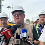
The program has recently found a new purpose after Metropolitan Manila Development Authority (MMDA) General Manager Nicolas Torre III tapped it this week to help with traffic engineering. The Philippines has emerged as the most congested country in Asia, while Manila and Davao City were ranked among the top 50 most congested cities in the world in the TomTom Traffic Index for 2025.
At first glance, traffic may not seem to fit into Project Noah’s conventional scope. But its geohazard maps can help identify areas that are vulnerable to floods, a perennial problem in the metro and one of the causes of road congestion. This undertaking with the MMDA demonstrates precisely why the program and the technology it has so far developed remain relevant and useful to Filipinos.
A research program
The program was established in 2012, a year after then President Benigno Aquino III called for a better disaster prevention and mitigation system following Tropical Storm “Sendong” (international name: Washi). Sendong had maximum sustained winds of 95 kilometers per hour, considered potentially dangerous, but not as much as a supertyphoon whose wind speed exceeds 240 kph. Despite this, its death toll breached 1,200, the majority of them from communities adjacent to the Cagayan de Oro river. Experts believe that these deaths could have been prevented had there been advanced geohazard technology that warned residents about imminent danger.
Project Noah was then launched as a research program under the Department of Science and Technology (DOST) tasked to address major gaps in the country’s disaster preparedness by developing technology that provides adequate flood warnings and enables local governments to prepare adequately. The program was set to conclude in 2015, but was extended until February 2017. At the time, Mahar Lagmay, its executive director, said funding should have continued until the goal of having fewer disaster-caused deaths had been achieved.
New lease in life
During its five-year run as a DOST program, the project made substantial achievements, including the development of an advanced early warning system of up to six hours for flash floods; high-resolution hazard maps for floods, landslides, and storm surges; as well as sensors that allowed for real-time monitoring for landslides, among others. Its mobile app Arko, designed to provide real-time, location-specific flood and rainfall data, received the United Nations World Summit Awards Mobile Content in 2014 and a silver prize at the 2015 Asean ICT Awards.
Despite these impact-driven projects, the program was forced to find a new home after its shelf life under DOST ended. The University of the Philippines adopted and relaunched it as Noah Center under the University of the Philippines Resilience Institute (UPRI) in June 2017.

Its new lease in life under the 2026 national budget should only be the beginning of strengthening and expanding its usefulness to Filipinos. One of its top priorities, now that it has a substantial budget, should be updating its hazard maps, that was last done in 2012.
National blueprint
The 35 million searches that have been made on the Project Noah website prove how it has been an important tool, particularly for accurate flood information. The next step for the government is to institutionalize the program; this way, it can insulate it from politics and leadership changes.
Several measures are pending at the Senate and the House of Representatives seeking to transform the UPRI into the UP National Climate and Disaster Resilience Institute. Once it becomes a national institute, it will receive direct appropriations under the budget law similar to the National Institute of Geological Sciences, which was created in 1983 through an executive order. This will enable it to establish plantilla positions for researchers and technical staff and ensure long-term capacity. It will no longer have to cut its personnel or scramble for funding like what happened in 2017.
How ironic it has been that a country considered among the most vulnerable to disaster has given the least priority to a DRRM program that saves lives. The Marcos administration can change that by paving the way for Project Noah to become an essential part of the national blueprint on DRRM. This is the only way to permanently save the platform, considered a lifesaver for millions of Filipinos.