


City planning vantage points: Top view vs street view
City planning, as a professional discipline, is often associated with maps or two-dimensional visualization.
As an all-encompassing endeavor, it is appreciated from a vantage point that allows a comprehensive view. Hence, seeing the geographical extent through maps or satellite images has aided planning for many years.
However, an alternative view is that urban design is best initiated from the ground level, where the planner is physically situated within—rather than on top of—the area being planned.
As a dynamic space with complex relational networks, a city needs to be understood in many layers and from different perspectives. Understanding it from the air and at street level provides baselines for laying down plans for its future.
The penchant for top views
First-time visitors often pay and queue up for a 360-degree view of the city, atop the tallest building, an observation tower, or a hilltop-perched view deck.
The overlooking vantage point orients people toward a better appreciation of the city. The coveted window seat in a plane allows a bird’s eye view, which forms first impressions of the city.
The organizational and psychological underpinnings of top views are seen in ancient settlements, raised citadels, and fortified medieval towers. Such strategically located view stations are essential to deploying power.
A top-down governance approach is enabled by the spatial translation of control from a privileged viewpoint. Elevated sites also account for defensible places that promote a sense of security and pride.
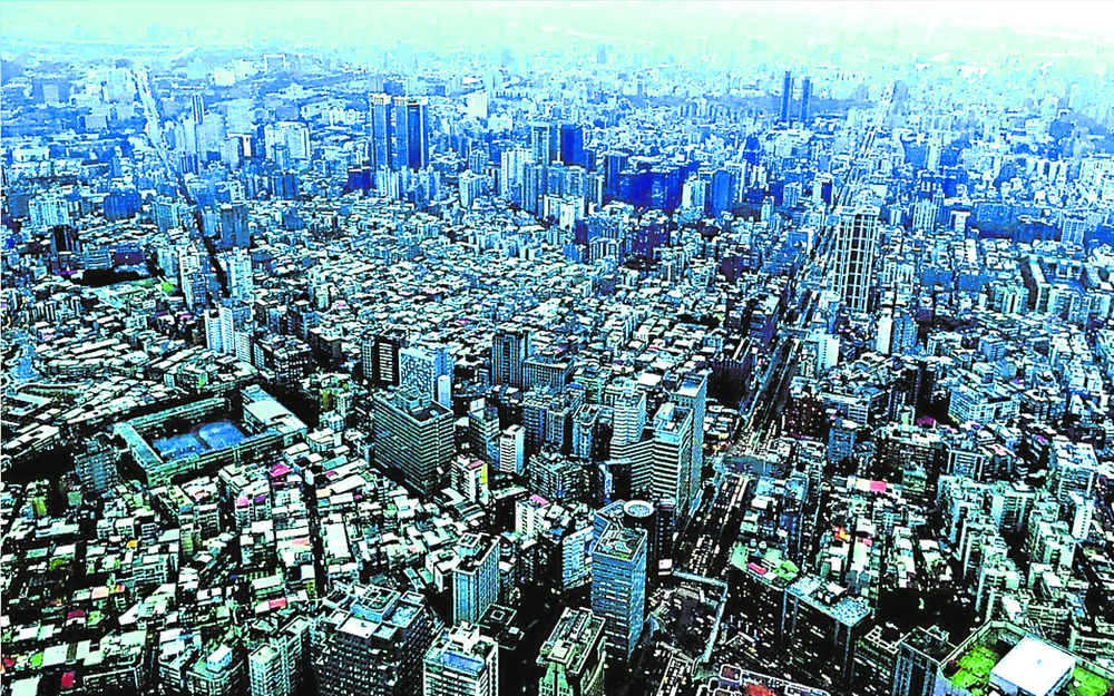
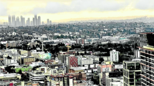
The top view advantage
Seeing the city as a whole entity enables a progressive understanding of it—taking off from the overall structure and then proceeds to the parts and details.
The top view affords appreciation of the city fabric, defined by the road layout, block sizes, and building footprints. Urban texture is also seen through the array of materials and surface finishes. Fine or coarse textures are defined by building densities and the juxtaposition of tall and low rise structures.
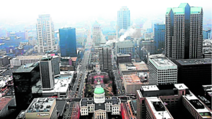
How the different functional zones relate to each other is easily figured out as well through relative distances and infrastructure linkages.
Likewise, how green and open spaces interact with the built forms is easily seen from a high vantage point. Development patterns and urban growth directions are indicated by the disposition of built and natural elements.
Post-disaster assessments are aided by top view scanning through drone and LIDAR technologies. The top view represents a rich dataset that can be analyzed and simulated.
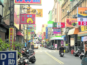
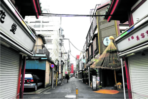
Value of street level view
Meanwhile, walking through the city’s roads and alleys allows “lived experiences” that provide a deeper grasp of the important planning baselines.
The design process is facilitated by urban space empathy through sensory connections. Planning from the user’s viewpoint makes for more responsive interventions. Issue-based urban design entails sensitivity to the rhythm of daily life in the residential and non-residential areas. Understanding how transaction spaces work through direct engagement can further provide input for planning for efficiency.
Navigating community and institutional spaces in the city can help put together the appropriate social models for functionally coherent cities.
Planners immersing themselves in the multifaceted realities of the city can better address design objectives relative to human scale, cultural sensitivity, and collective productivity, among others.

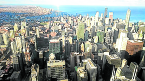
Urban design movements, planning practices
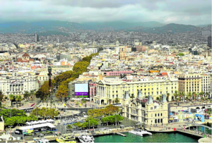
The City Beautiful movement has guided the development design blueprints of Paris, Chicago, and partly Manila.
The view from the top of these cities is characterized by intentional patterns of roads, blocks, and green spaces. The rational disposition of landmarks and ceremonial public spaces accounts for place orientation and branding.
Land use planning is based on data-based allocation of land for the different urban functions. Zoning ordinances are based on development controls that are supposed to guide urban densities and intensities.
Placemaking theories zoom into neighborhoods, streets, and activity areas within the city. Spaces are voids that evolve to become places with the melding of people and design elements that create character.
Places are experienced as the people’s faculties of sight, smell, hearing, touch, and taste interface with the physical attributes of the streets, parks and buildings.

Optimizing value through top and street view planning
Both viewpoints are important when steering the city’s life toward the desired direction. The comprehensive view afforded by an aerial scan from the top, and the human scale view offered by the curbside standpoint, provide information sets that may be interwoven.
Feeding both into the planning process enables planners to address both macro and micro level issues. Neighborhood quality is enhanced by the ability to understand the whole and its parts for short and long term future visualization.
The author is an architect, urban planner, and professor at the University of the Philippines Diliman College of Architecture